
A customizable routing engine providing directions, isochrones, and distance matrices using OpenStreetMap geographic data.
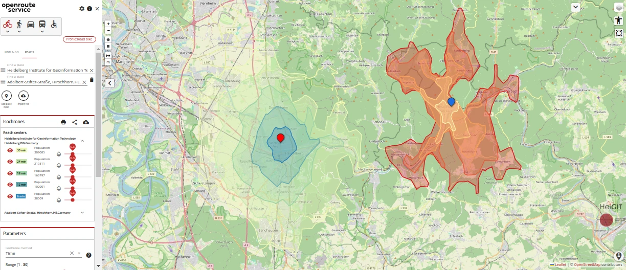
OpenRouteService is an open-source routing service written in Java. It provides spatial services by consuming free geographic data from OpenStreetMap to calculate routes and analyze accessibility. The software functions as a backend engine that processes geographic coordinates to provide precise routing data for various transport modes.
The software is deployed as a server and is typically installed using Docker and Docker Compose. It exposes a set of API endpoints that allow users to integrate routing and distance calculations into other applications. For those who prefer a visual interface, a demonstration server is available that includes both the backend engine and a frontend web application for testing and exploration.
Key features
- Directions service for various modes of transport
- Isochrones service to determine areas of reachability from specific locations
- Matrix service for one-to-many, many-to-one, and many-to-many time and distance calculations
- Snapping service to align coordinates to the road network
- Export service for the base graph of different transport modes
- Health endpoint for monitoring the running instance
- Status endpoint for checking instance information
The system is built on a modified version of GraphHopper 4.0. It is designed for developers and organizations requiring a self-hosted routing engine for logistics management and supply chain infrastructure. The server architecture allows for the persistence of graphs, logs, and elevation caches on the host machine through Docker volume mapping. Users can customize the service by providing their own OpenStreetMap files to define the geographic area the engine covers.
OpenRouteService serves as a technical foundation for applications requiring customizable routing and spatial analysis based on OpenStreetMap data.
Similar Open Source Software

Caddy
An extensible web server platform that provides automatic HTTPS by default for all hosted sites.

Traefik
An HTTP reverse proxy and load balancer that automatically configures routes for microservices in cloud environments.


Join our newsletter to get shiny new open source software delivered to your inbox. Unsubscribe anytime.