Convert real world geographic data into detailed Minecraft Java and Bedrock Edition worlds using OpenStreetMap.
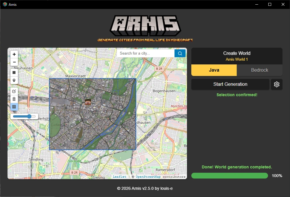
Arnis is an open-source tool that generates Minecraft worlds based on real-world geographic data. It allows users to recreate specific locations, such as hometowns, big cities, or natural landscapes, by translating real-world topography and architecture into Minecraft blocks. The software supports both Minecraft Java Edition (1.17+) and Bedrock Edition, providing a way to import actual geography into a voxel environment.
The application is available as a desktop program for Windows, macOS, and Linux. Users select a specific area on a map using a rectangle tool and link the software to a Minecraft world folder to begin the generation process. The tool can be used via a graphical user interface for ease of use or through a command line interface for more technical control over the generation parameters.
Key features
- Integration with OpenStreetMap for architectural and geographic data
- Processing of elevation data for accurate terrain representation
- Support for both Minecraft Java and Bedrock editions
- Customizable world scale and spawn point settings
- Option to toggle building interior generation
- Map-based area selection via a rectangle tool
- Command line interface for automated world generation
- Cross-platform compatibility for Windows, macOS, and Linux
Built with Rust and Tauri, the software uses a modular architecture to separate data fetching, processing, and world generation. This design ensures that components remain distinct, which helps maintain performance during the translation of complex geospatial data into Minecraft formats. The software processes data from the Overpass API and other elevation sources to ensure that the resulting terrain reflects the actual height and layout of the chosen real-world location. It is designed for Minecraft players, map makers, and designers who require accurate real-world representations within a sandbox environment.
Arnis serves as a specialized utility for converting OpenStreetMap and elevation data into playable Minecraft environments, offering a free alternative to manual world building for geographic recreations.
Similar Open Source Software

GDevelop
Build 2D, 3D, and multiplayer games for mobile, desktop, and web using a no-code event system.

OpenSpeedy
Modify the execution speed of Windows games by hooking system time functions via a desktop interface.
Join our newsletter to get shiny new open source software delivered to your inbox. Unsubscribe anytime.